Black Canyon of the Gunnison is a National Park situated along the Gunnison River in western Colorado, and includes one of the steepest canyons in the United States. Like the larger and more famous Grand Canyon in Arizona, the park may be accessed from either side of its respective river. Unlike the Grand Canyon, there is no bridge across the river. Anyone wishing to go down to the Gunnison River, which is far below the park's designated trails, needs to acquire a permit.
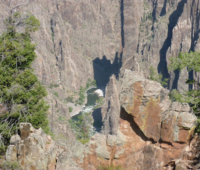
I decided to enter the park from its southern entrance, since from the south side, I could look at the canyon with the sun behind me. The north side would thus be largely in sunlight, although the rugged shapes of the canyon's walls, their steepness, and the bending of the river would result in some areas still being in shadow. Near the South Rim Visitor Center is a viewing area called Gunnison Point. From there, I took this shot across the canyon, showing some land beyond its north side.
This picture includes some trees in the foreground, and a little bit of the river.
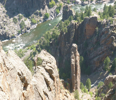
There were some crags and boulders on the near side of the river.
A vertical column of rock stands in a small side gully.
After leaving Gunnison Point, I hiked the Oak Flat Trail, which makes a two-mile loop starting near the visitor center. As I had previously experienced in the Grand Canyon and Bryce Canyon National Park in Utah, I subjected myself to the first law of canyon hiking: What goes down must come back up, after you're already tired. Early in the hike, the trail led over a small area of exposed rock, of two different types and colors.
From one place along the trail, I could see some more of the trail below me. After a while, that's where I was. Another section of the river is in the background.
As the trail led back upward, I could see some rock formations on the near side of the canyon.
Not long after taking that last picture from the trail, I made it back to the visitor center and then drove off to other parts of the park.


No comments:
Post a Comment