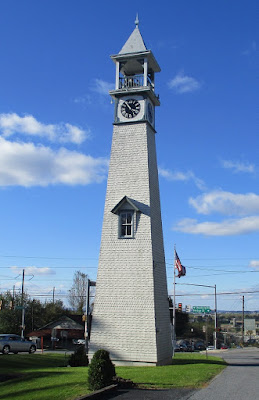
At Gap, PA 41 runs into US highway 30, known along much of its length as the Lincoln Highway. I proceeded westward and found a place to eat and then a place to stay for the night. The next morning, before eating an early lunch, I found this Dutch-themed business.
Following a combination of Pennsylvania routes 896, 741, 272 and 372, I found my way to the Lock 12 Recreation Area, located just off PA 372 on the west side of the Susquehanna River. A short trail led from the parking lot to the lock, which passed the side of an old limestone furnace.
The trail continued over a bridge, which spans a small stream.
The lock was surrounded by walkways, from one of which I could take this shot from the side away from the Susquehanna. At the far end is another small bridge.
I was also able to see the inside of the lock from its southeastern end.
Finally, I took a shot from the side closer to the Susquehanna.
After taking these photos, I got back into the new Bigfootmobile and found my way back to Maryland and home.


No comments:
Post a Comment