In my general part of Maryland is an
international latitude observatory, which in conjunction with five others, is used to measure the wobble in the earth's rotational axis. This motion is known as
precession. The observatory was operated by human observers from its establishment in 1899 until 1982. Today it is still active, with GPS systems using the survey markers around the observatory to make course corrections. The area surrounding the observatory has become a local park. Here is the observatory building, surrounded by a circular fence, seen from an east-west walkway which marks its latitude. The name "Cincinnati Ohio", where another observatory is located, appears on concrete slabs running perpendicular to the walkway. The names of other locations appear on similar slabs.
This shot shows the observatory from the southwest. There is a door at the end of the short narrow entrance way to the left.
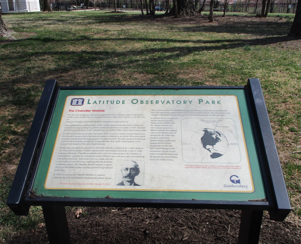
This is one of several interpretive plaques in the park. It explains
the Chandler wobble, named after its discoverer.
The meridian mark pier is located directly south of the observatory, and is likewise enclosed by a circular fence.
Looking eastward away from the observatory, the walkway is seen leading back toward a nearby road. Seen upside down from this perspective are two slabs which read "Ukiah" and "California".
Read more about the observatory at the link on the top line above.


No comments:
Post a Comment