Tuesday, November 18, 2014

One Last Look At Sedona

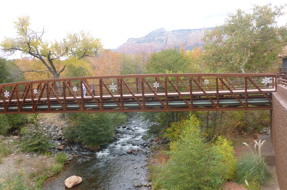
Here are the last few pictures I have from Sedona, taken during my last full day there.  Not far from where I stayed, there is pedestrian bridge over Oak Creek.  I took this picture of the creek from the bridge.

Here's the bridge itself, with a couple looking down at Oak Creek to get the same view as I had in the first picture above.

Also near where I stayed is a shopping area called Tlaquepaque, which includes this fountain.

And finally, here was the view from my balcony.


Monday, November 17, 2014

Amitabha Stupa

The Amitabha Stupa and Peace Park is located in northwestern Sedona.  It may be reached from state highway 89A by driving north on Andante Drive (one of several nearby streets named for musical terms) and then turning left onto Pueblo Drive.  The park includes a parking lot and driveway, both unpaved.  Like the surrounding rocks, the dirt (or more precisely, dust) that you drive on is reddish.  Along with the namesake stupa, the park also includes the smaller White Tara Stupa, which is about six feet tall, and shown here with the Amitabha Stupa in the background.  You can also see papers with prayers written on them and strung onto lines.

The back of the White Tara Stupa was in sunlight, with some nearby houses in the background.

The Amitabha Stupa is 36 feet tall, with four flag lines connecting to its apex.  One of them appears to be just about right above me.  In the background is a formation that I believe is called Chimney Rock.

Here's a close-up of Chimney Rock.

The back of the Amitabha Stupa was in sunlight, with a small seating pavilion in the background.

Near the Amitabha Stupa is a wooden statue of the Buddha.

Near the pavilion is this prayer wheel.

Read more about the Amitabha Stupa and Peace Park at Kunzang Palyul Choling and Wandering Educators.

Monday Links

I'm back in Maryland, so back to the routine I go, passing on stories in the news.

From LifeNews, a baby is born after his mother had taken the first pill of a multi-pill abortion drug.

From the Independent Sentinel, the DEA raids NFL teams in response to a civil lawsuit.

In the National Review Online, Matthew Continetti warns that executive amnesty for present illegal aliens will invite the next wave of illegal aliens.

From Politico, support for Obamacare hits a new low.

From Legal Insurrection, a British scientist who worked on the successful comet-bound Rosetta project has come under attack from feminists because of his shirt - which had been given to him by a woman.

From Reuters, Japan's economy unexpectedly slips into recession, causing their prime minister to consider delaying a sales tax increase and calling a "snap election".

From UPI, British and American industries are trying to improve aircraft wing technology.

From The Weekly Standard, the Supreme Court announces that they will hear King v. Burwell.

From Criminal Justice News, an alleged leader of a Mexican drug cartel has been extradited to the United States.

From CNS News, a high school in Virginia, in a reversal of an earlier decision, allows students to start a pro-life club.

From Real Clear Politics, former President Bill Clinton says, "I never bought this whole lame duck deal."

From Metro, two Australians trying to join ISIS are rejected for being too fat.  (via Breitbart London)

From Fox News, police are bracing themselves for possible violence in response to the upcoming Grand Jury decision on whether to indict Ferguson police officer Darren Wilson.

From The Daily Caller, the chief of the EPA says that the current pause in global warming "doesn't represent climate".

From ABC News, Pope Francis has confirmed that he will visit Philadelphia.

And from the New York Post, women can now get a boob job that lasts 24 hours.

Sunday, November 16, 2014

Music Break

Now that I'm back home, it's time for a music break.  The first selection is For The Heart by Elvis Presley, which I first heard back in college because one of my roommates had the album which included the song.  Although from the 1970's, its backing vocals remind me of the Jordanaires, who appeared on over 300 of Elvis's songs starting in 1956.

Red Rock State Park

Red Rock State Park is located southwest of Sedona, and may be reached from state highway 89A by either Red Rock Loop Road or Upper Red Rock Loop Road.  I used the former to reach the park and attempted to leave via the latter, only to find a sign the said "pavement ends", so I ended up leaving the same way I came in.  The park straddles Oak Creek, downstream from Oak Creek Canyon.

Just after starting my hike, I saw this rock formation, the top of which I would later reach by the Eagle's Nest Trail.

Just after starting my hike, I came upon two of the local residents.

Here's a view from somewhere along the Coyote ridge Trail.  The building near the left edge of the photo is the visitors center.

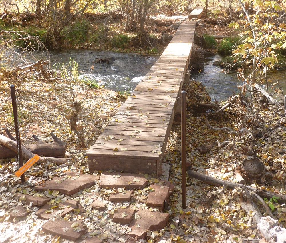
The Sentinel Trail includes these bridges over Oak Creek.

The Wikipedia page on this park includes the rather interesting story about how the park came to be.
Red Rock State Park was previously a part of a ranch, Smoke Trail Ranch. In 1941 it was purchased by Jack Frye, then-president of Trans World Airlines, as a southwestern retreat for himself and his wife Helen.[2] Helen Frye maintained the property for many years after Jack's death in 1959. In the early 1970s she sold 330 acres (130 ha) to a real estate development company, who planned to build a resort complex. The deal fell through from lack of funds. In 1976 the property was transferred to Eckankar, a new religious movement that Helen Frye belonged to, who planned a private retreat for their members.[2]
In the fall on 1980 a group of friends hiking along Oak Creek were informed by an Eckankar representative that they were trespassing on private property. The group happened to include Bruce Babbitt, then-governor of Arizona. Concerned about loss of public access along waterways, Babbitt researched the property and noted its potential for a full-fledged state park. After determining the willingness of all parties involved, Babbitt pursued a three-way land exchange: Eckankar would sell 286 acres (116 ha) of the Smoke Trail Ranch to Anamax Mining Company, who would donate the land to the state in exchange for 3,947 acres (1,597 ha) of Arizona State Land Department property they had been leasing in Pima County. Since state law only provided for such exchanges within a county, the Arizona Legislature had to pass new legislation allowing trans-county trades. The enabling law and the transfers were completed in 1981.[2]
As it turns out, footnote [2] refers to the "history" page of the park's website, the main page of which is linked on this post's first line above.  The apparent lesson is that if you're going to trespass on private property, it's a good idea to bring your state's governor with you.

Saturday, November 15, 2014

Petrified Forest, Part 5

The section of Petrified Forest National Park north of Interstate 40 extends into an area called the Painted Desert.  The park's main road includes several places to pull off and view the desert.  I took this picture from Whipple Point.

This shot is from Pintado Point, with Pilot Rock in the background, just right of center.

A short side road leads northward to Chinde Point, from which I took this picture.

This shot is also from Chinde Point, in a direction a bit eastward from that of the picture just above.

The last place I stopped in the park was the Painted Desert Inn, which is a National Historic Landmark in its own right.


Friday, November 14, 2014

Petrified Forest, Part 4

After Newspaper Rock, the next stop on my trip through Petrified Forest National Park was Puerco Pueblo, thought to have been built and occupied by people of the Ancestral Pueblo culture, who were to some extent influenced by Mogollon people living to the south.  Here's part of the largest structure at Puerco Pueblo.

Here's another section of the same structure.

Near the ruins are some large rocks with some petroglyphs on their surfaces.

Here are a few more.

Puerco Pueblo also includes this smaller structure.

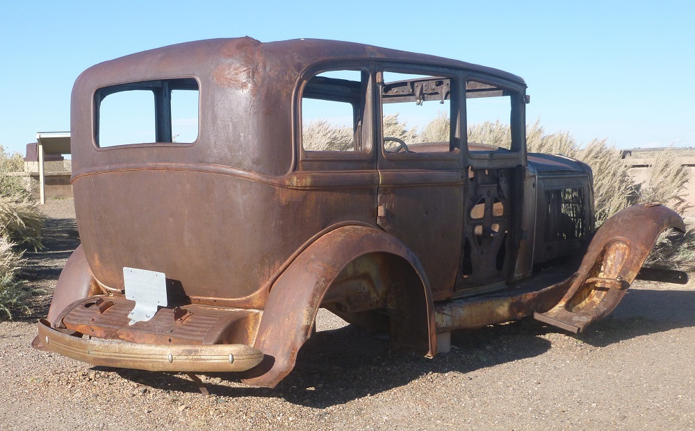
To see more of Puerco Pueblo, go here.  Going north from Puerco Pueblo, the park's main road goes over the Burlington Northern Santa Fe railroad tracks (the old Santa Fe main line) and then over Interstate 40, but there is no interchange.  About 1000 feet north of I-40 is a memorial to historic U.S. 66, which includes some of the old pavement and this Studebaker.

The main road would eventually curve eastward and again meet I-40, where there is an interchange and the northern entrance to the park.  Some sights along this remaining stretch will be shown in the next post, which will be the last one about Petrified Forest.

Petrified Forest, Part 3

After viewing the Crystal Forest and Jasper Forest areas of Petrified Forest National Park, I made a brief stop at Agate Bridge, a petrified tree lying sideways over a ravine.  It has been reinforced with a concrete slab.

I continued northward and made a series of stops in the Blue Mesa area, reached by a road extending eastward from the park's main north-south road.  In this shot, a petrified log sits on top of a light grey hill.

Nearby was another pile of white boulders.

North of Blue Mesa is this area of brown soil, broken up by dry riverbeds.

Some formations in Blue Mesa have multiple layers of different colors, as seen here.

 This is another shot of what are called the Blue Mesa Badlands.

North of the Blue Mesa turnoff, just off the main road, are the formations known as the Tepees.

The Newspaper Rock area is reached by a short road extending westward from the main road.  It's not a single rock, but a large pile of boulders, some of which have petroglyphs drawn on their surfaces.  This type of rock art was often carved onto dark areas, known as rock varnish.  Near the center of the next shot, there is a dark panel with some markings, but I can't really tell if they are petroglyphs.

Here's another shot that includes a dark rock surface, but it does not have any clearly seen petroglyphs.

In any event, Newspaper Rock in Petrified Forest National Park should not be confused with Newspaper Rock in southeastern Utah.

Thursday, November 13, 2014

Petrified Forest, Part 2

After my hike in the Giant Logs and Long Logs areas of Petrified Forest National Park, I continued northward to the Crystal Forest, which likewise includes a trail.  This picture shows a fairly large log, with some visitors walking on the trail in the background.

A bunch of other logs is in the Crystal Forest.

I took this shot from the end of a very long log.

Some of these logs appear to have been thinly sliced.

I thought this one had the most interesting colors.

As I was about to leave the Crystal Forest parking lot, this raven was hanging around.

I proceeded over to an area called the Jasper Forest, which did not include any trails.  Instead, this forest is seen from an overlook.  These rocks are pretty close to the overlook.

Here's the view looking farther away.

Once again, a raven was keeping watch.  Edgar Allan Poe would be proud.


Petrified Forest, Part 1

Petrified Forest National Park is located in eastern Arizona, about 100 miles east of Flagstaff.  The park has one main road, running generally north-south between its two entrances, one off Interstate 40 in the north, the other off U.S. Route 180 in the south.  I entered from the latter.

Near the south entrance is an area called Giant Logs.  In this first photo, it seems that I've unintentionally created some false perspective.  The person who appears to stand on the log is actually in the background.  The log's diameter is only around three or four feet.

Here's a group of logs, on either side of a trail.

Petrified wood isn't the only type of rock featured in the park.  This pile of boulders in the Giant Logs area might be made of white sandstone, a fairly common type of rock in the western United States.

This panoramic shot was taken from the Giant Logs area.

Another group of giant logs.

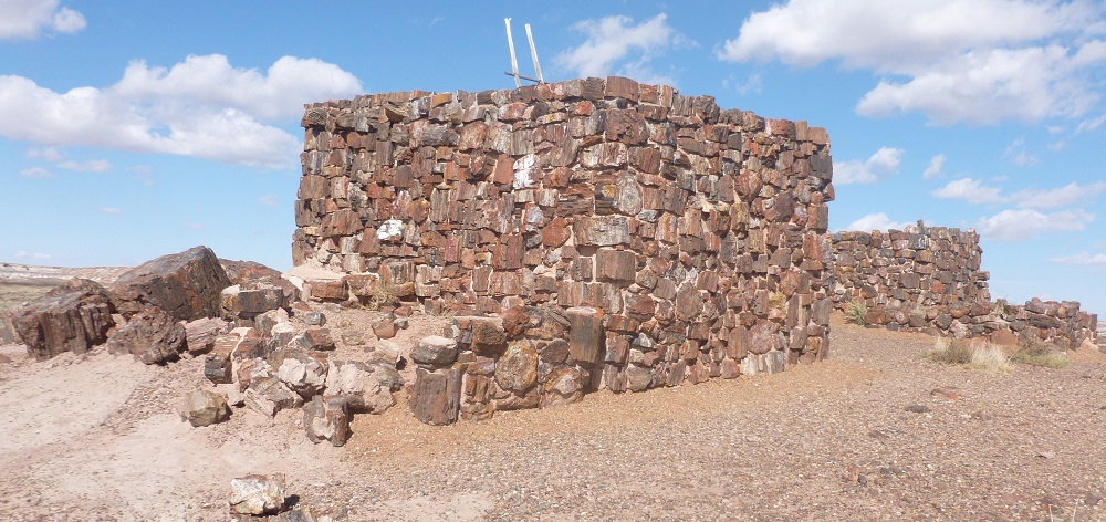
The Agate House is a partial reconstruction of a structure built by Puebloan Indians, from petrified wood.  It can be reached by a trail leading from the parking lot for the Giant Logs area, and which passes through an area called Long Logs.  This picture shows about half of Agate House.

The rest of Agate House is shown here.

On way back from Agate House, there was another pile of white boulders.

This is part of the Long Logs area, with some multicolored hills in the background.