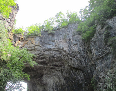
On my way to an undisclosed location in Virginia, which is on the way to an as yet undisclosed location in Tennessee, I decided to stop in at Natural Bridge, Virginia and see the actual natural bridge, which is the main attraction in its namesake state park. I've driven over it on previous trips to the area, because it's a section of U.S. 11, but I've never previously seen it from the sides or bottom.
To see the bridge, I went to the park's visitor center, paid a fee, and proceeded down a designated trail. Not only does the trail go under the bridge, but so does Cedar Creek, as seen here from the east side of the bridge.
On the trail under the bridge, a little girl appears to ponder the creek.
A closeup of the upper part of the bridge, seen from the west, shows a wooden fence, which would be on the side of U.S. 11.
Further up Cedar Creek and the trail is a reconstructed Monacan Indian village.
A look inside the reconstructed village.
I returned toward the bridge and took another shot of its west side, focusing on the rocky surface toward the right.
This last shot was from a different angle, but shows the same section of the fence.
According to Atlas Obscura, Virginia's Natural Bridge was surveyed by George Washington and owned by British King George III, who sold it to a colonist named Thomas Jefferson. Not long afterwards, Mr. Jefferson told His Majesty that he and his fellow Americans would no longer be colonists, and as the saying goes, the rest is history.


No comments:
Post a Comment