This sign, between a viewing pavilion and a flagpole, tells you where you are on the Appalachian Trail.
Here's the view from the pavilion, with some trees in the foreground. Pen Mar Park sits above a valley to the west.
I turned north and hiked along the trail. This barrier keeps motor vehicles out of the park, but hikers can go around it.
After the barrier, the trail turns left and goes across a railroad track.
A sign shows you where to cross.
Continuing northward, the trail crosses the border of Maryland and Pennsylvania, a.k.a. the Mason-Dixon Line. At this intersection, there is a sign and a mailbox in a stone column. The mailbox contained a notebook in which I could have written something had I wanted to.
On the Pennsylvania side, these signs indicate that the trail at this point runs along an old trolley line.
Continuing northward, the trail intersects PA Route 550, a.k.a. Pen Mar Road. Another barrier keeps motor vehicles out of the trail.
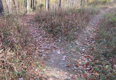
After another 200 yards or so, the Appalachian Trail and the old trolley line part ways. The AT goes to the left and further northward into Pennsylvania. The trolley line goes to the right and eventually curves back down into Maryland. I did neither, but turned around and returned to Pen Mar County Park.
Using GoogleMaps, I estimate that I walked a little less than 3,000 feet each way, so my total hike may have been just over a mile. Since this was done in the morning, I had enough time to return home and post my regular two-part list of things going on.


No comments:
Post a Comment