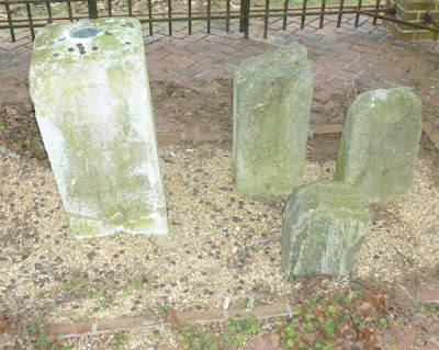
The southwest corner of Delaware is marked by the first stone used to set out the Mason-Dixon line. Today, it is enclosed by a structure made of brick columns and iron fencing, along Maryland route 54 a few miles east of Mardela Springs. In this photo, the stone is viewed from a southwest angle, in which a smaller darker stone appears behind the stone used to mark the corner of Delaware. Numerous coins appear to have been tossed into the enclosure, including a few that landed on the marker stone itself and stayed there.
This view is from the east, in which what appeared to be a smaller stone behind the main stone in the first picture is actually three smaller stones. From this angle, there's a better view of the coins sitting on top of the main stone.
While the Mason-Dixon Line is thought to be the boundary between Maryland and Pennsylvania, it also includes the boundary between Maryland and Delaware, which runs north-south to the north of these stones and east-west to the east of them. This would mean that I was standing in Delaware when taking the second picture.


No comments:
Post a Comment